Fisherman’s Wharf by the numbers


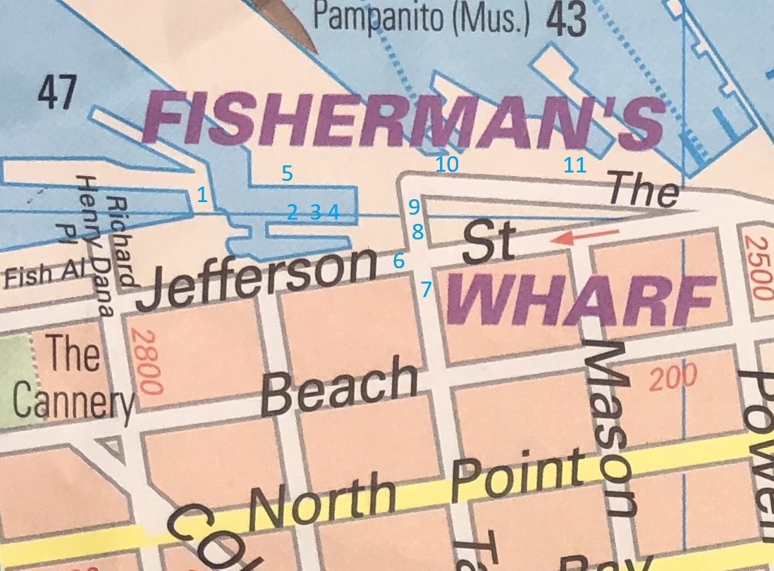
I took another trip to Fisherman’s Wharf on the last Sunday in 2025 to do some comparison pictures from old photos from the UC Berkeley Library (UC) and San Francisco Digital Library (SF) Archives, and I’m happy to say that it was packed. I enjoyed doing this two post ago, so I took another picture of the Fisherman’s Wharf portion part of my beat up ‘City In Your Pocket’ San Francisco street map, and I photo painted in blue numbers this time where I took my pictures. (Thumbnail images)


#1 Looking east across Fisherman’s Wharf Lagoon in 1938. That tank in the background was filled with gas! Can you imagine how hazardous that would be today? You can see Joe DiMaggio’s Restaurant on the far right in the old picture; That’s where Supreme Crab is now. (UC)


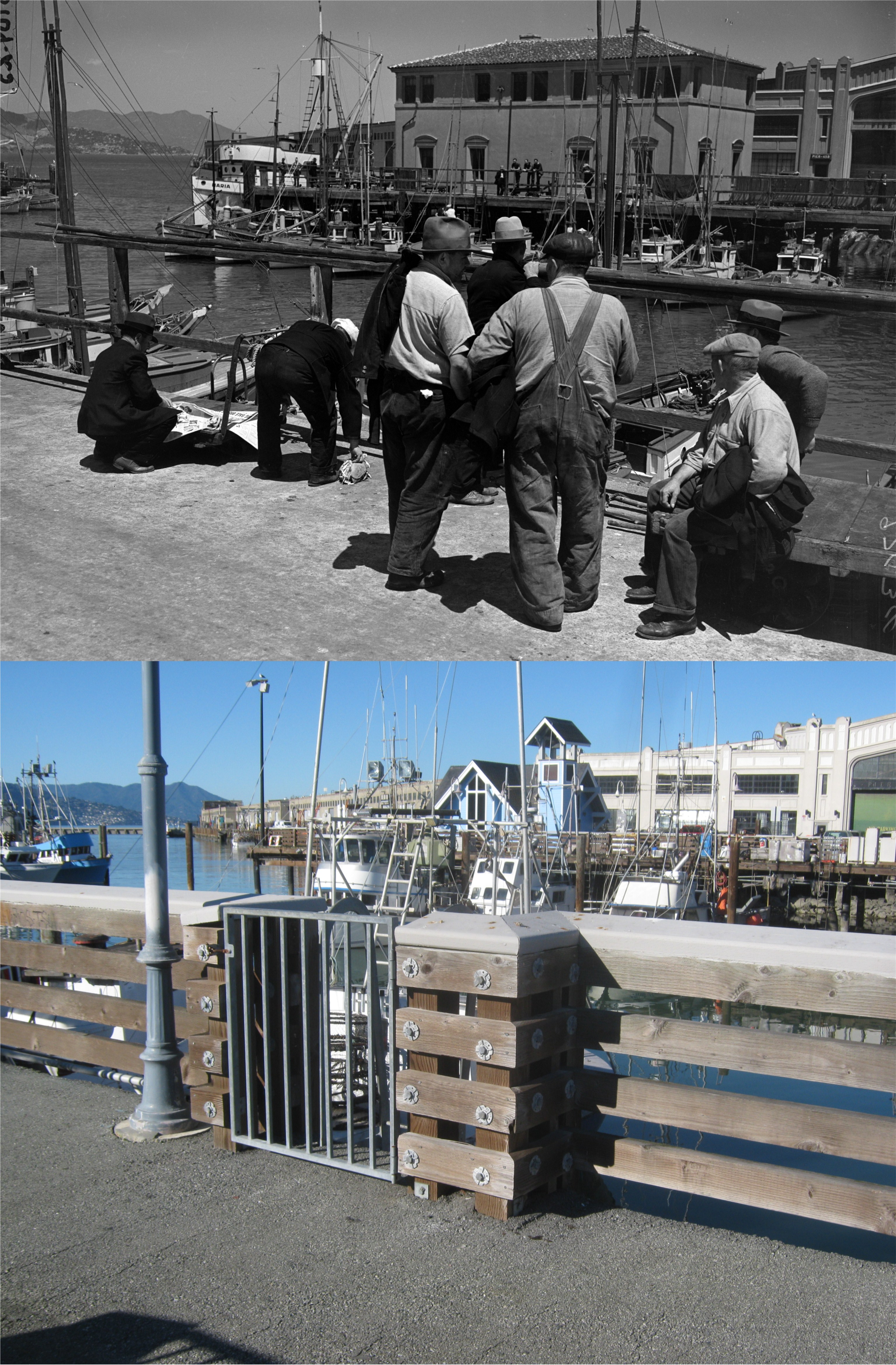
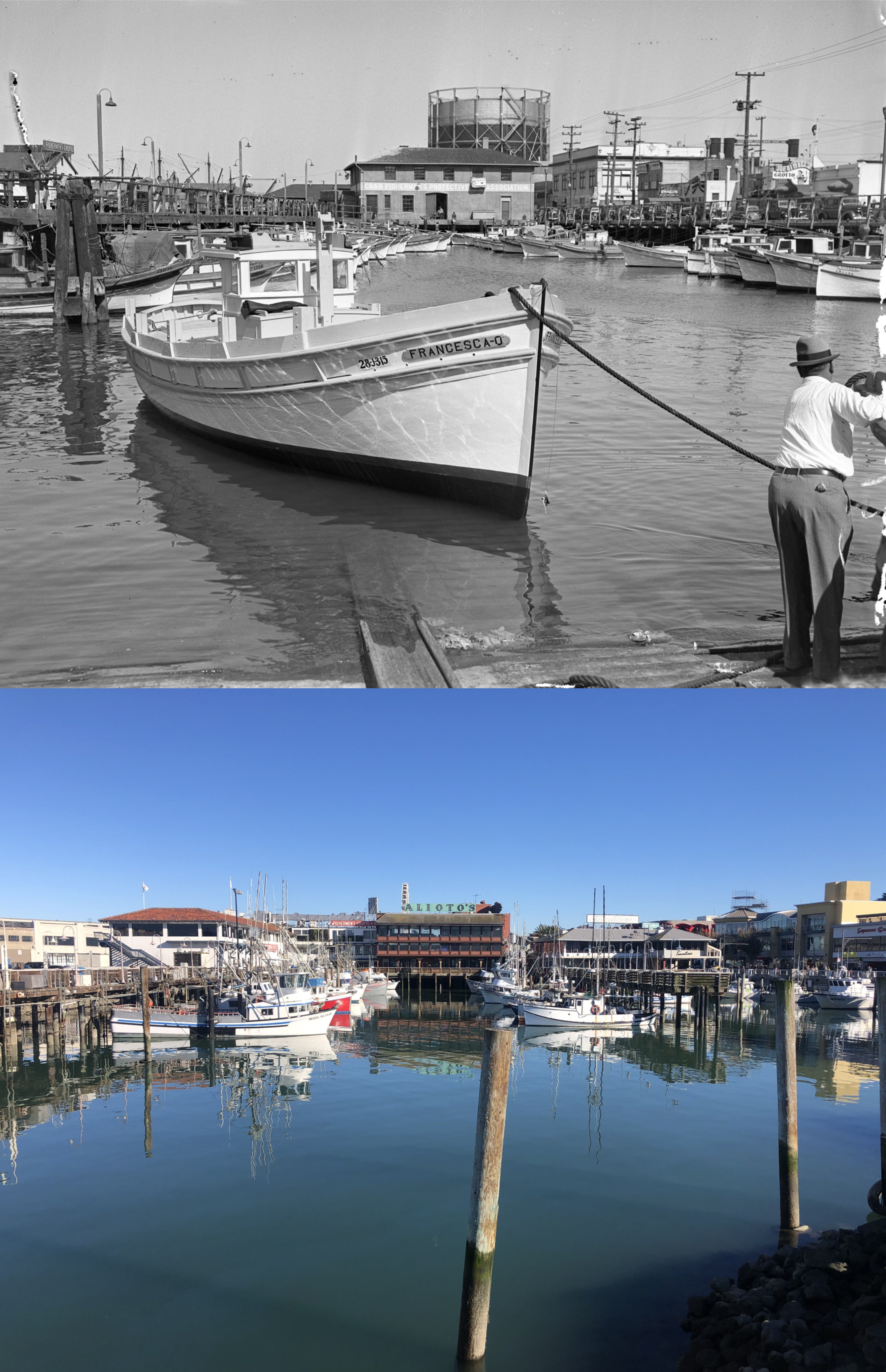
#2 Fishermen looking northwest across the Lagoon in 1939: The Fisherman’s Chapel is now where that big building was in the background. (UC)


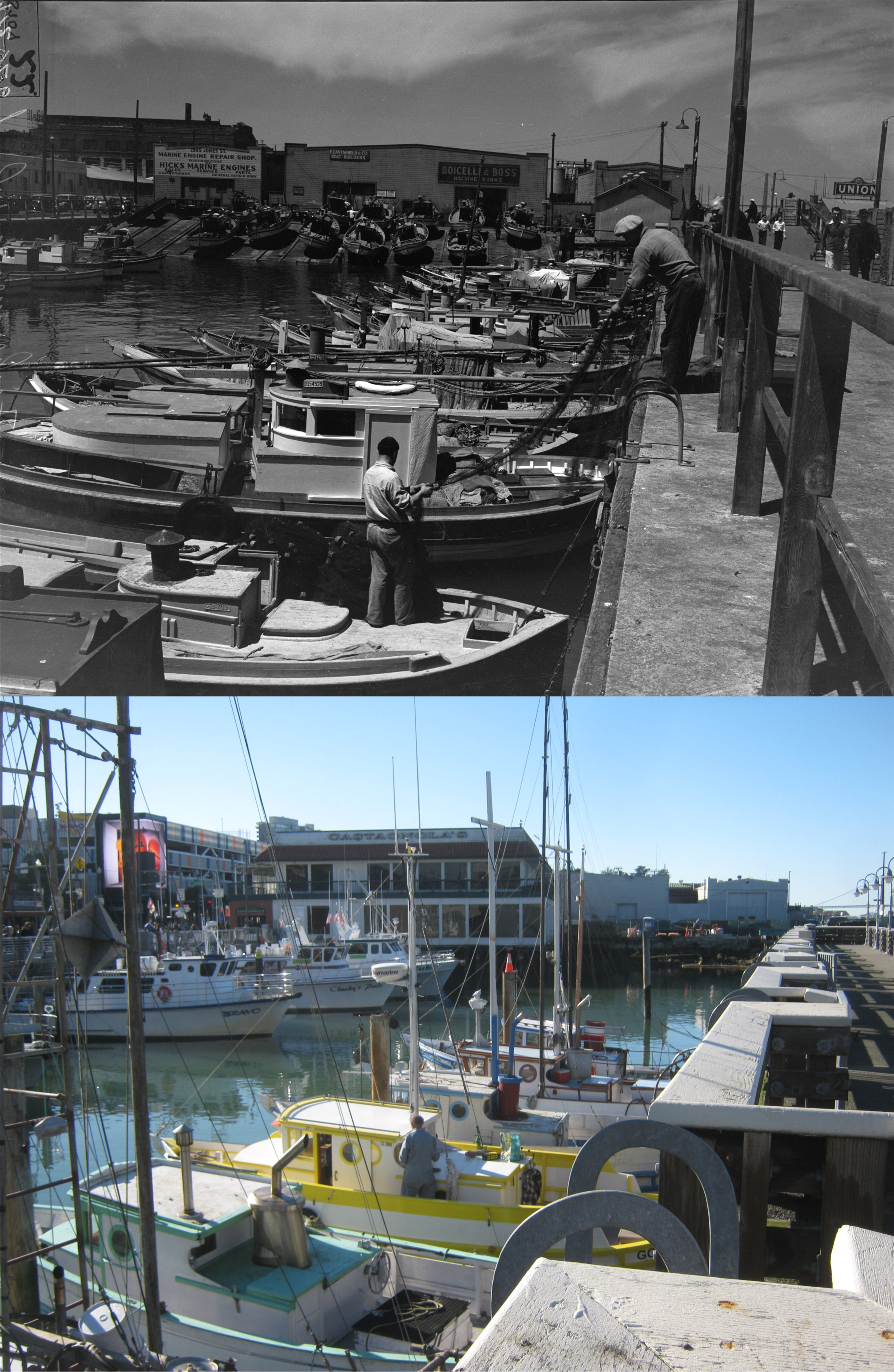
#3 Looking west, also in 1939, toward where Castagnola’s Restaurant is now. (UC)


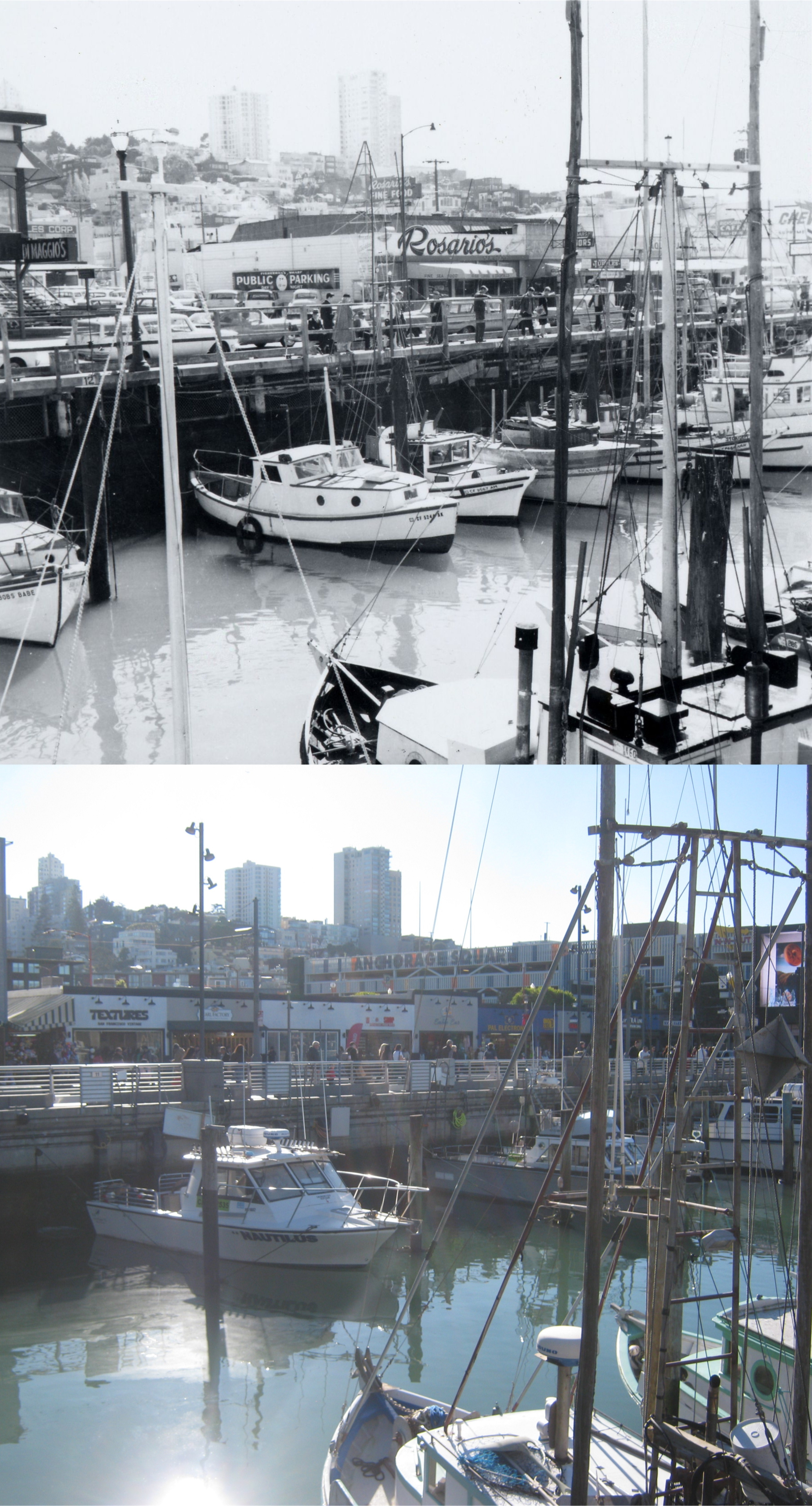
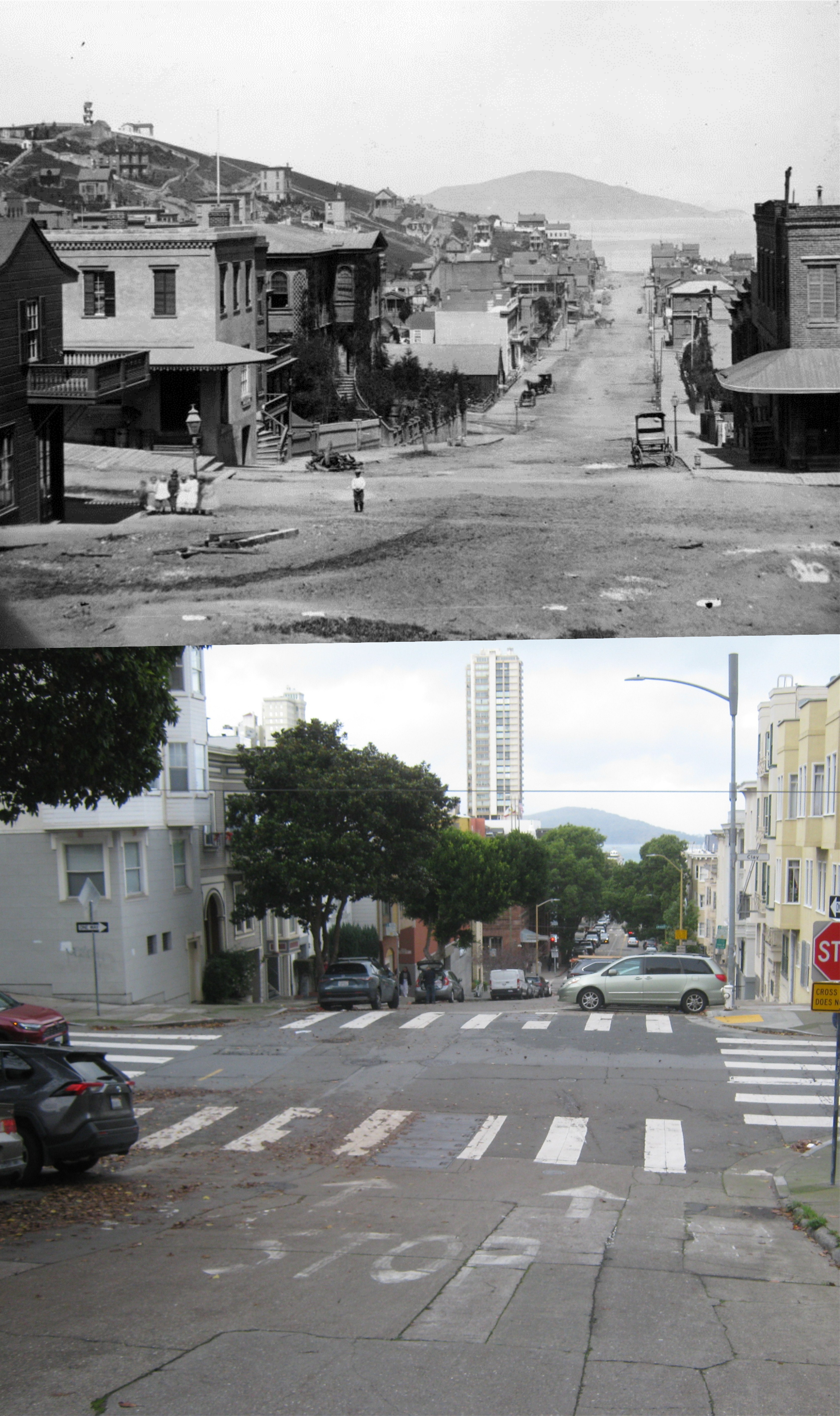
#4 Looking southwest toward Russian Hill in 1965: (SF)


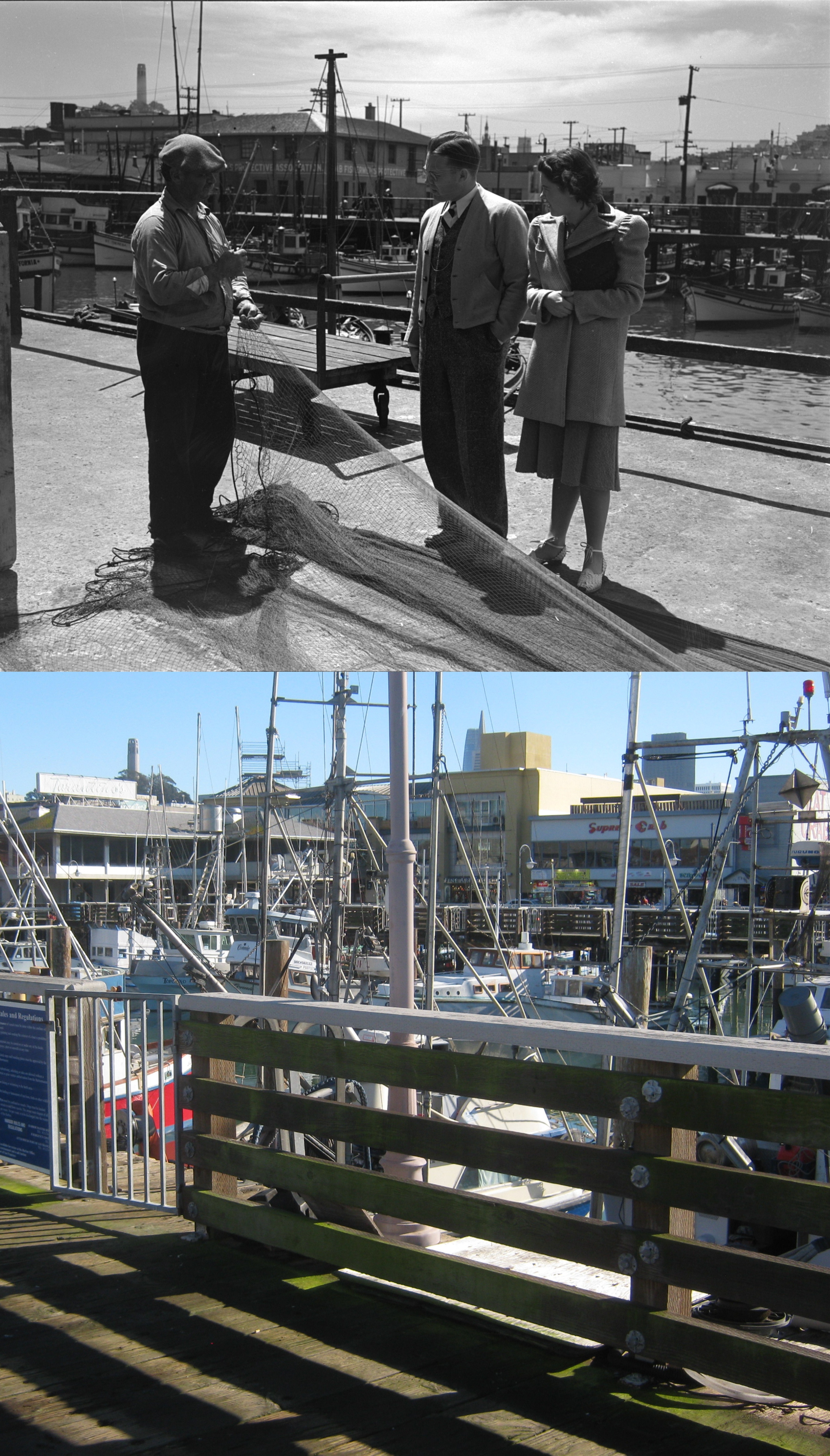
#5 Looking southeast in 1939 from the opposite side of the Lagoon as the previous three pictures. Coit Tower is on the left in both photos. (UC)


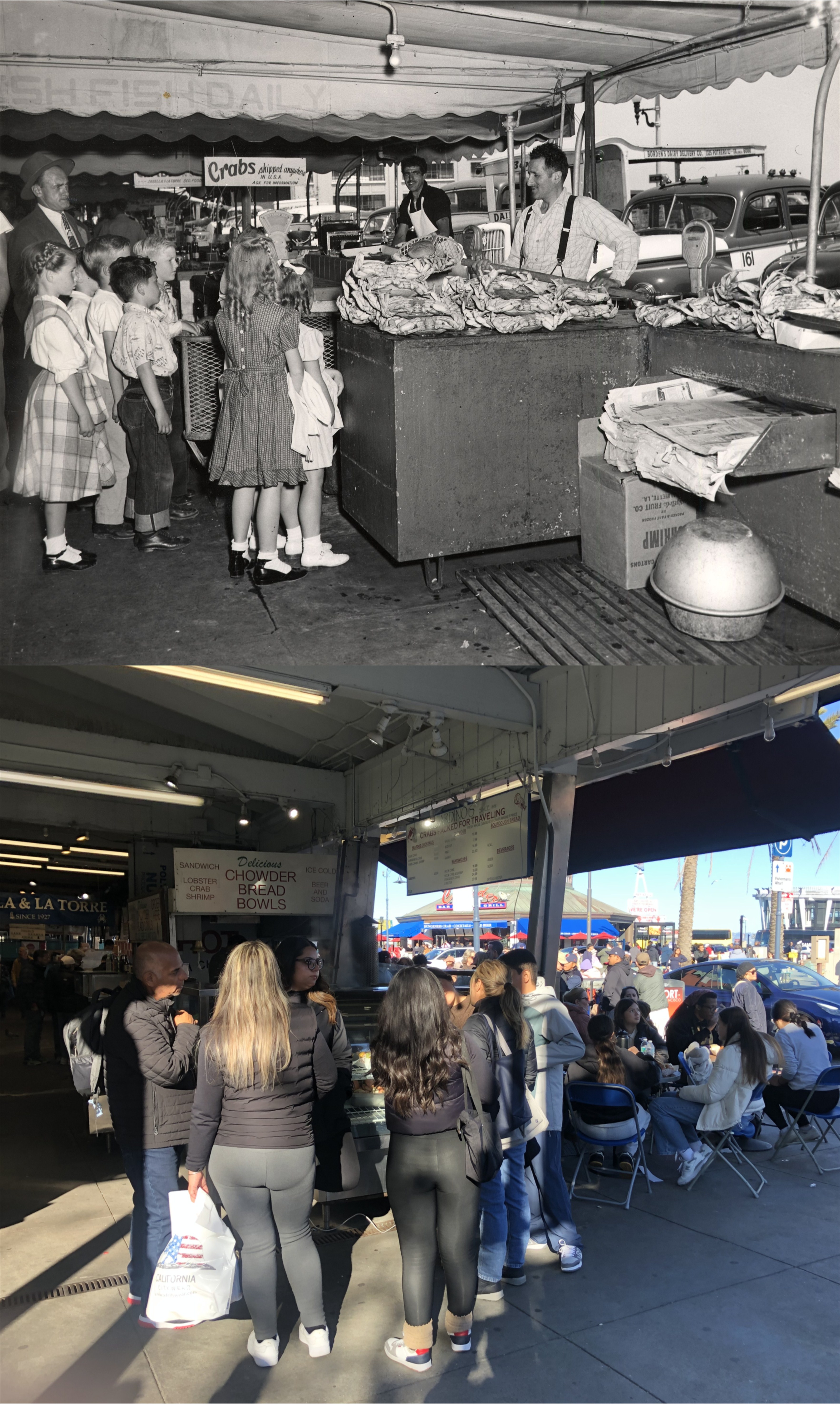
#6 Kids at the northwest corner of Jefferson and Taylor Streets in an undated picture from the 1940s, and the same corner last Sunday: (SF)


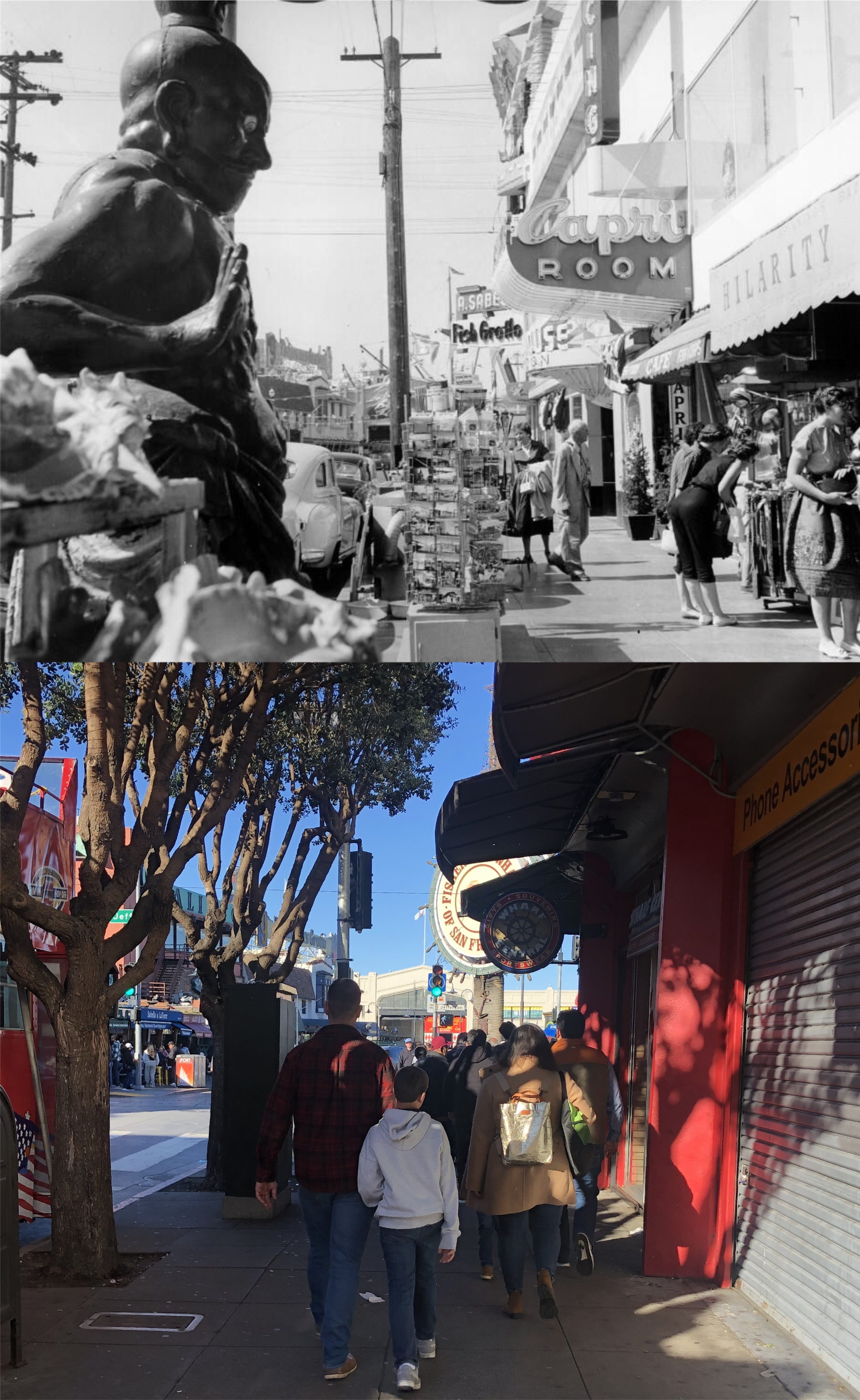
#7 The southeast corner of Jefferson and Taylor Streets, where Applebee’s is now, in 1958: I told you it was crowded. (SF)


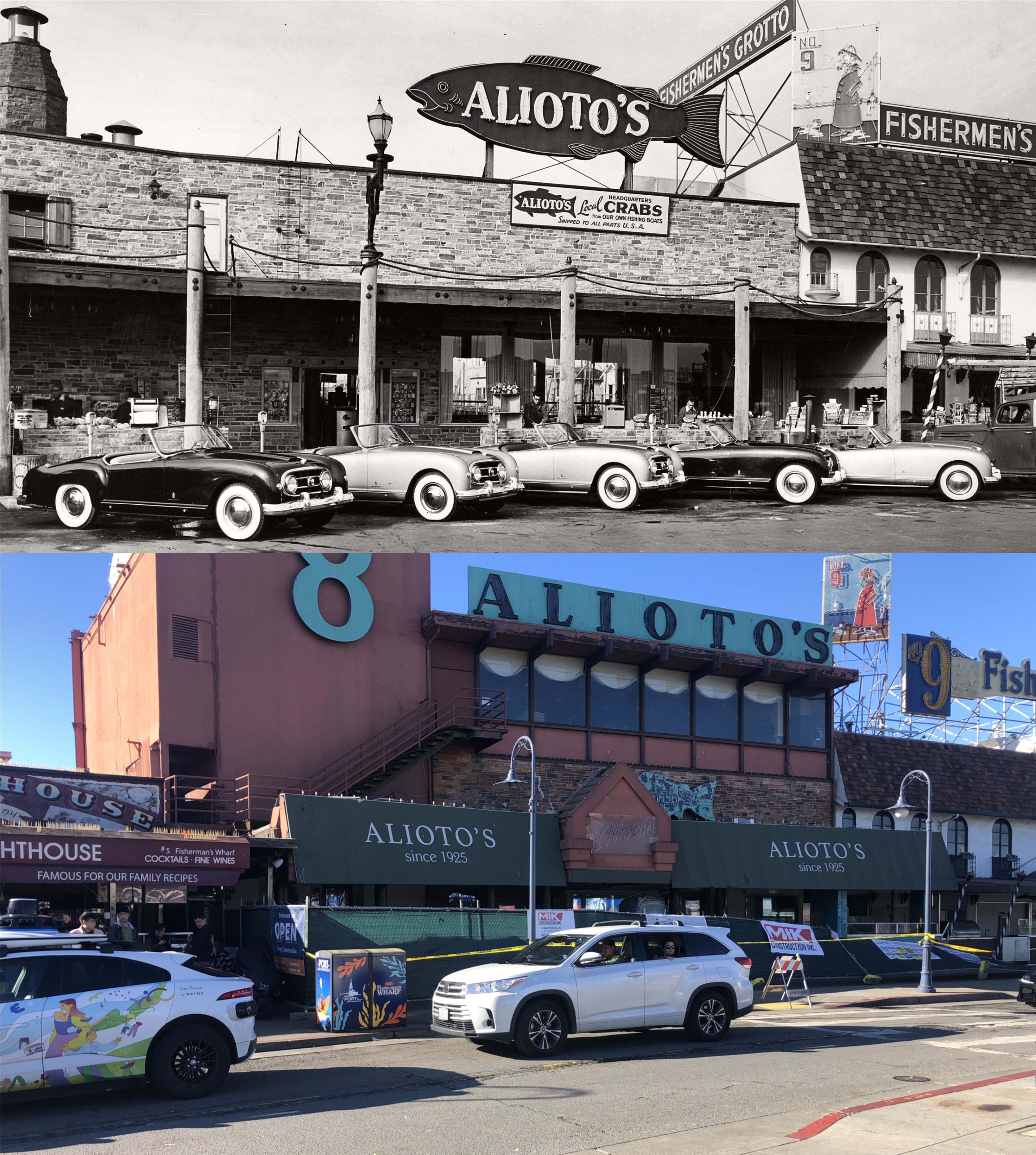
#8 Looking toward Alioto’s Restaurant in 1953: I hate to see Alioto’s fenced and taped off like that. (SF)


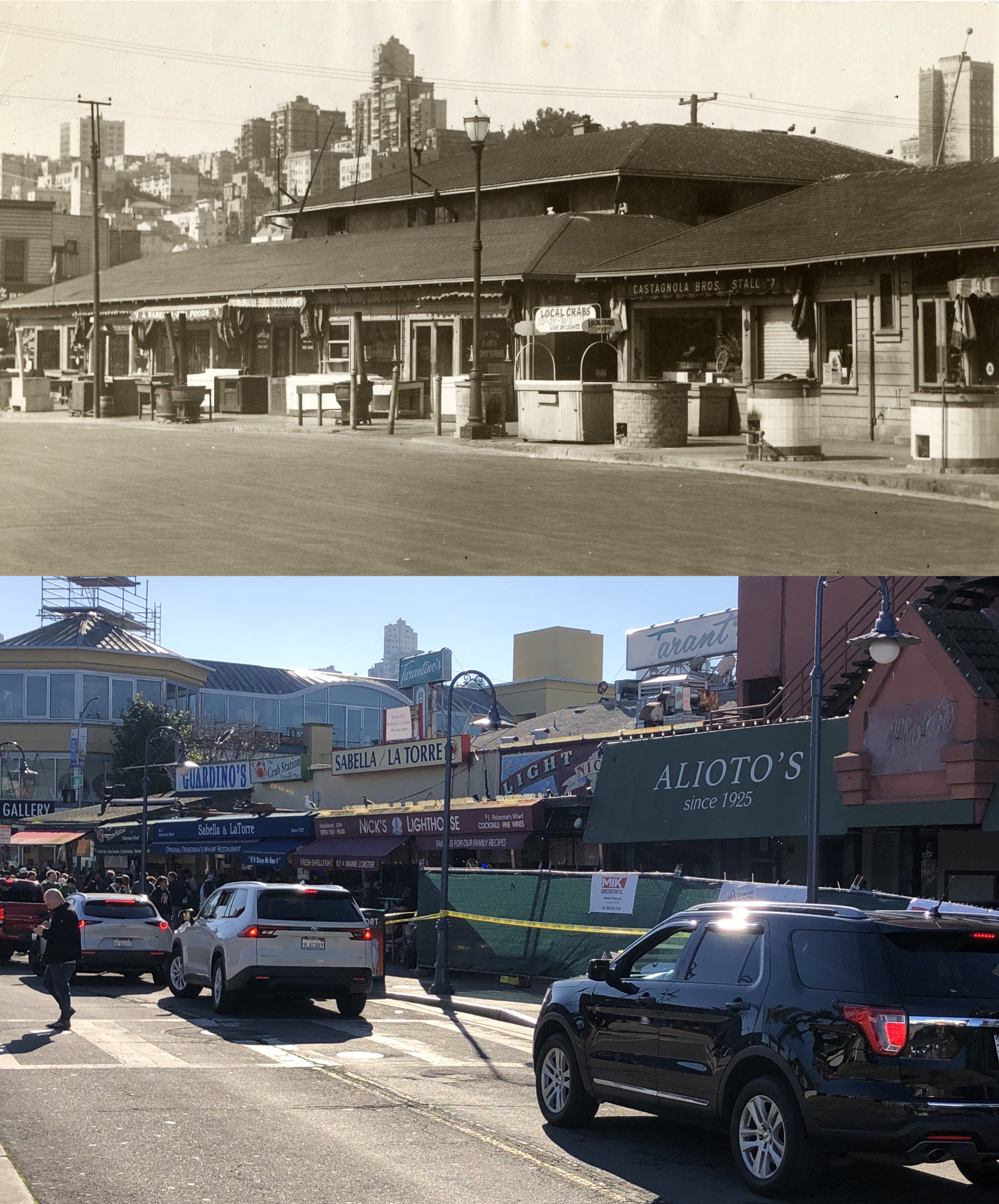
#9 Jefferson Street in 1934: Everybody was packed into the small corner left open here on this Sunday. (SF)


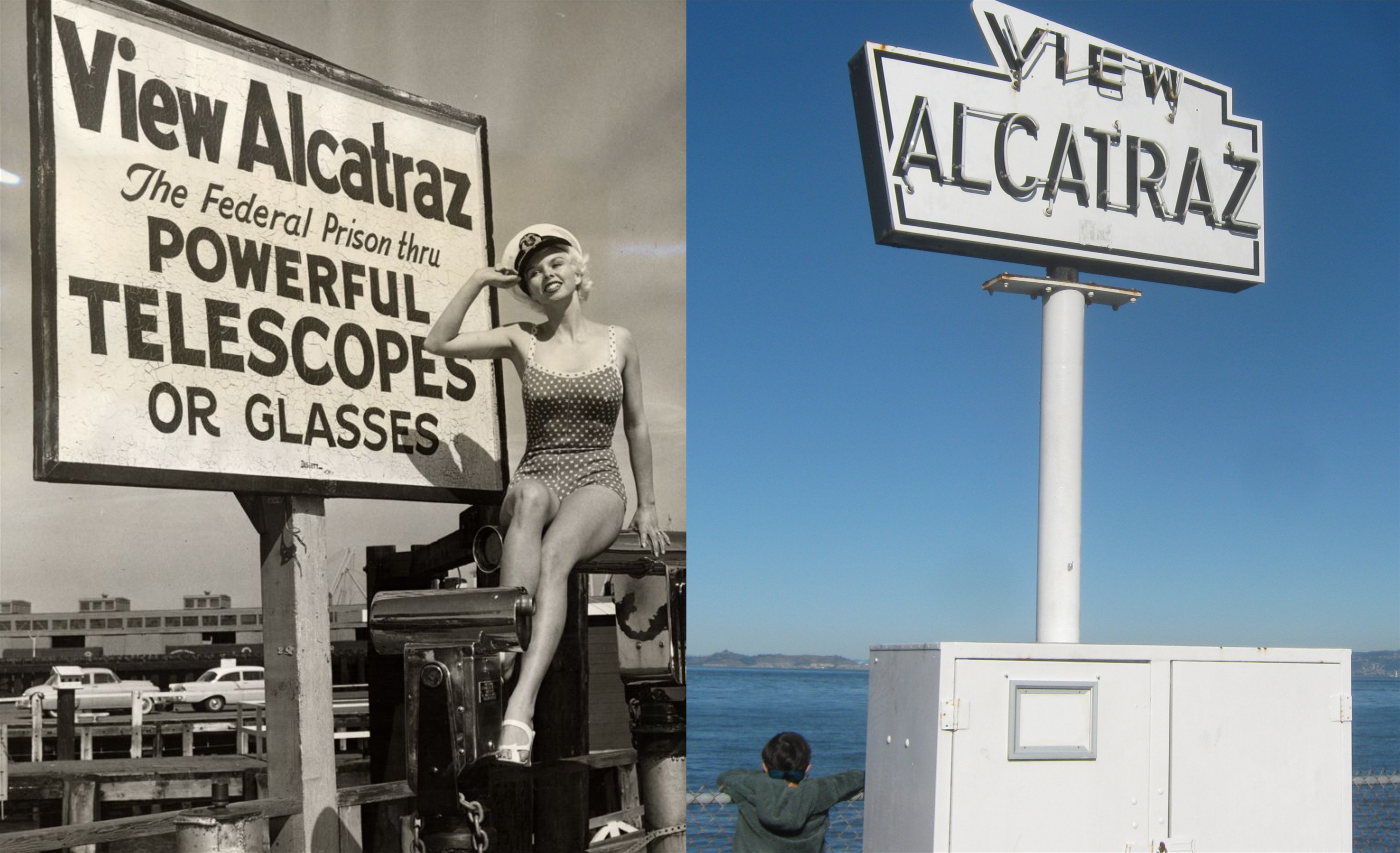
#10 Also, there’s something lacking in today’s ‘View Alcatraz’ sign, as compared to ambiance of the 1957 one. (SF)


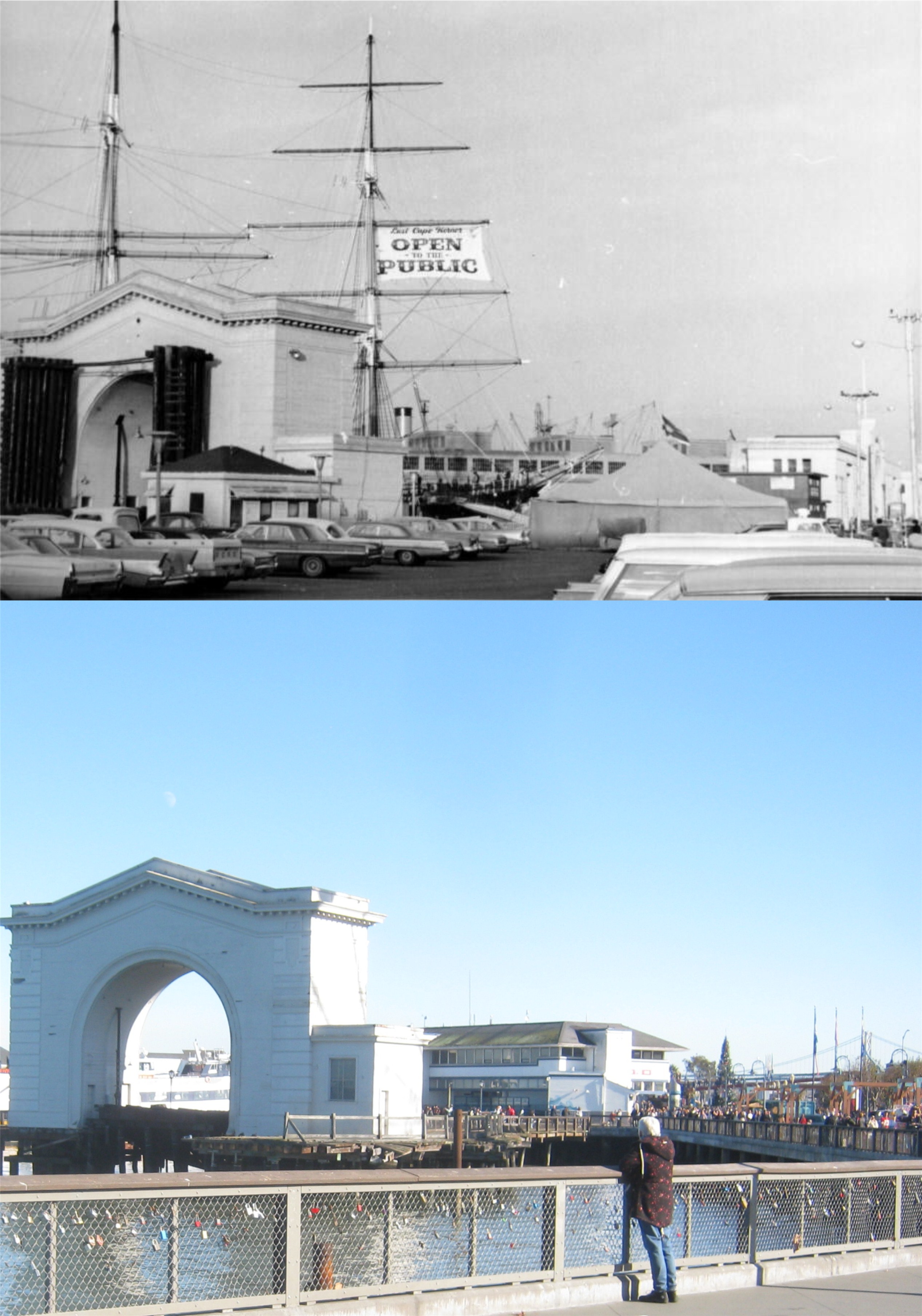
#11 Pier 43 in 1967 when the sailing ship, the Balclutha, was still berthed there:


‘Wall Street of the West’

The “Wall Street of the West” was what they used to call Montgomery Street, but the COVID Pandemic and the amount of empty office space has, at least temporarily, made that expression a thing of the past. I took a walk along Montgomery Street over the Holidays to take some pictures, and I’m posting them on New Year’s Eve. To quote Abraham Lincoln, (well, he might have liked my blog) “it is altogether fitting and proper” that I post these on this day, because Montgomery street used to be ground zero for New Year’s Eve celebrating in the white collar world of Downtown San Francisco. (Thumbnail images)


We’ll start out looking north along Montgomery Street from across Market Street at New Montgomery Street in 1939. The building on the far left has been demolished and the building behind it has been reduced to two stories. The building behind those two is the Hunter-Dulin Building where it’s generally believed Sam Spade’s office was in the ‘Maltese Falcon’. It was either 10:30 or 11:00 when I took my picture. (UC Berkeley Library Archives)


Looking north along Montgomery Street across Post Street in 1939. Post Street doesn’t cut across to Market Street here anymore. The building in the background is the Russ Building, the tallest building in San Francisco in 1939. You can see a portion of it in my picture. (UC Berkeley Library Archives)


Looking back toward Market Street and the Palace Hotel in 1910: (San Francisco Library Digital Archives)


Looking northwest toward Sutter Street at Montgomery in 1939: (UC Berkeley Library Archives)


The Wells Fargo Building at Montgomery and Sutter Street in 1973: I don’t think that it’s stretching the point to say that this isn’t a bad comparison. Ta da boom! (San Francisco Library Digital Archives)


Looking down Pine Street toward Market Street in 1924: Two of the buildings on the near right and the Matson Shipping and PG&E Buildings on Market Street in the far center are still around. (San Francisco Library Digital Archives)


Approaching California and looking back toward Market Street in 1939: (UC Berkeley Library Archives)


Montgomery at California Street, the epicenter, and that’s probably not a good descriptive word to use lightly in San Francisco, of Wall Street of the West in 1953: (San Francisco Library Digital Archives)


Back down near Market Street for a little New Year’s Eve celebrating in the late 1950s or early 1960s: It was customary up until the 1990s for office workers to throw ticker tape and calendars out of their windows in Downtown San Francisco, and everywhere else, on New Years Eve. (SF Chronicle)


Montgomery and Bush Streets in the 1950s: (SF Chronicle)


Montgomery at Sacramento Street in 1981: New Year’s Day was cleanup day in Downtown San Francisco, and Happy New Year! (SF Chronicle)

#1 up and #1 down: Another Nob Hill visit (For Castro Valley Vibe)

There are certain ways not to relax in San Francisco; one of them is walking up Nob Hill. I’ve done it often enough, but nowadays when I climb Nob Hill, it’s usually aboard the #1 MUNI bus heading up Sacramento Street. Walking down Nob Hill isn’t as tiresome as walking up, but if I’m real lazy, I take #1 MUNI heading back down Nob Hill along Clay Street. I made another visit to the hill of the nabobs over Christmas to update some vintage photographs from the UC Berkeley Library Archives, and to visit the Fairmont Hotel Lobby, always a pretty site during the Holidays. (Thumbnail images)


I took a picture of part of my old and beat up ‘City In Your Pocket’ San Francisco street map that I like because the streets are streets and not just lines, and I photo painted in red numbers where I took my pictures, just for fun.


#1) Sacramento Street at Taylor in an undated photo from the 1940s, looking west. The expanded portion of Grace Cathedral is on the left in my picture. The cable car in the old photo is heading uphill and west.

#2) An undated photo from the 1950s, looking southwest from Jones Street: The tall building in the center of the vintage picture is the old Empire Hotel Building. You can still see the top part of it my picture.


#3) Looking down a cobblestone Jones Street from California Street in 1923: Traffic flows the other way now, and this is one of the scariest streets to drop over on.


#4) Looking along California Street toward Taylor in 1928: The Masonic Temple blocks out most of the view of the Huntington Hotel on the right from here now. The Pacific Union Club and the Fairmont Hotel are on the left and center. Looks like some kind of truck fire on the left in the vintage picture.


#5) Looking across Mason Street from Sacramento Street toward the Fairmont Hotel in 1908: This is a good time to step into the Fairmont Hotel.

#6) They do it up right during the Holidays in the Fairmont Hotel Lobby. The view from the Roof Garden is nice too, although, any angle that makes the Trasamerica Pyramid and the Bank of America Building look taller than the Salesforce Tower, which is actually the tallest building in San Francisco, is okay with me.


#7) Heading down Mason Street to Clay Street to catch the #1 MUNI back down Nob Hill. That’s an interesting pose on the 1876 photo of the intersection of Clay and Mason Streets; the man is standing in the street while what appear to be women and children are standing on the corner. I guess he just didn’t want them to be injured by any fast moving buggies. Obviously, the camera in the 1876 picture was further back from the intersection than I was. (San Francisco Library Digital Archives)


#8) This is an interesting 1940s picture to me, as well. Those are cable car tracks of the downhill cable cars heading east. Apparently, some cable cars turned north at Mason on that line, and headed to Fisherman’s Wharf. I didn’t know that! Incidentally, this was the exact route that Andrew Hallidie ran the very first cable car in August of 1873, although, he was heading uphill in the opposite direction. This original cable car route closed in 1942. I would like to have got a better lineup, but I had a bus to catch, and I just got across the street in time to get on the #1 MUNI back downhill.


#9) #1, which starts its return journey way out west by Lands End, is usually standing room only at this point, and this day was no different.

Following in my own footsteps (Part five)

Closing out the set of 1980s slide pictures I had converted into digital recently by Digital Revolution: (Thumbnail images)


An old time streetcar leaving the Transbay Terminal, turns on to Mission Street from Fremont Street in August of 1983, (I think) and a bus leaving the Salesforce Terminal turns on to Mission from Fremont now. The Salesforce Tower blocks out the view of the old Pacific Telephone Building from here now.


This area wasn’t exactly “groovy pot-pie” (a girl I know named Kiki use to say that in the 80s) when I took this picture under the Bay Bridge 17 years before Giants Stadium changed all that.


Wow, I don’t know what was going on here, but it made a nice picture from the Embarcadero south of the Ferry Building.


Fisherman’s Wharf from the footbridge that goes from Pier 39 to the parking garage: The SkyStar Wheel blocks the view now, but that doesn’t bother me, I like that thing.


The Embarcadero from Telegraph Hill: Back in 1983, they painted most of the piers mellow yellow and baby blue. I remember that I didn’t think that was groovy pot-pie either. They’ve changed them back to pier gray now.

Winter Walk, 2025

The SantaCon visits the Winter Walk: SantaCon started out in San Francisco 1n 1994 as, basically, a pub crawl, but now it’s become more of an anti-tradition. Yesterday, SantaCon occurred on the opening day of Winter Walk, 2025. I believe Winter Walk, where Stockton Street is carpeted and closed to traffic from O’Farrell Street to Post Street, began in 2016. The vintage pictures are from the San Francisco Library Digital Archives. (Thumbnail images)


The intersection of Geary and Stockton during the 1940s: The vintage picture is undated, so I’m not sure what all of the flags on the city of Paris Department Store were all about.


This must have been a doozy of a traffic jam on December 28, 1945, for these ladies to be jaywalking with their child. This is looking toward O’Farrell Street; you can see the Macy’s Clock in both photos.


This is another take on the Alan Canterbury Maiden Lane picture from 1964. The Winter Walk Band, playing Christmas songs, is stationed here.


Another look at the Geary and Stockton Streets intersection, looking east on Geary toward the Palace Hotel: The vintage photo is from 1910.


Looking north along Stockton Street in 1911: Union Square is on the left, Maiden Lane on the right.


The intersection of Stockton and Post Streets, as people head toward the Winter Walk: Not much of a crowd here on March 16, 1943.


“A splendid time is guaranteed for all!” unless you’re planing on driving down Stockton Street. These photos were taken from above the Stockton Tunnel. A literary note, Sam Spade looked down from this spot, before proceeding on to Burritt Alley to identify the body of his murdered partner, Miles Archer, in the ‘Maltese Falcon’. {Spade crossed the sidewalk between iron-railed hatchways that opened above bare ugly stairs, and resting his hands on the damp coping, looked down into Stockton Street. An automobile popped out of the tunnel beneath him with a roaring swish, as if it had been blown out, and ran away.}

Following in my own footsteps, part four (For Digital Revolution)

These are updates of early 1980s slide pictures that I took around San Francisco, that I had converted into digital at Digital Revolution on 9th Street, San Francisco. They weren’t always so easy to do comparisons on, as I couldn’t remember where I took some of the original pictures from. I updated them yesterday on a misty at times Sunday, and I’ll post some more that Digital Revolution converted in a the future, as soon as I enlighten myself on where the locations of my slides were taken. (Thumbnail images)


We’ll start out in Chinatown. Obviously, this slide was in Chinatown, but that wasn’t much help because sometimes Chinatown seems bigger to me than Hong Kong, which is true because I’ve never been to Hong Kong. It was at Commercial Street coming into Kearny, about half a block away from Portsmouth Square. I think this one was 1983.


I’m not sure why I took this picture of an alley in 1983, except I think I remember liking the view of one of the Bay Bridge towers from the alley. I remembered it was near Levi Plaza when I Google Maps searched for it; it’s in the middle of the Battery, Front, Union, Green Streets block, and named John Maher Street. They’ve spruced up the alley quite a bit, which means it was important to somebody other than me, but the view of the Bay Bridge is gone now.


This one made me a little nervous, I was worried that I couldn’t go out on that ledge anymore without falling to my death! Just kidding, I wouldn’t have gone out on the ledge in 1984! This was taken from the fire escape of the O’Farrell-Mason Garage. What I was actually nervous about was that the spot wasn’t there anymore, I haven’t been there in over forty years! Progress has blocked out the view of one of my favorite San Francisco buildings now, the dome shape Humboldt Building.


Other than a change in the cars and trees, time hasn’t altered the view down Clay Street from Powell much.

Of course, the first thing you’ll notice in this set, I’m mean after the St. Francis Lutheran Church, is that Napolitana Pizza is now Casa Mexicana Restaurant. This was taken from the 1934 #228 open air Streetcar from Blackpool, England, heading back to the Transbay Terminal at what may have been the first Trolley Festival in San Francisco in 1983. This was at Market and Church Streets. The festival features vintage streetcars running along Market Street. I’ve also included a slide picture of the streetcar I took that day, and Market Street Railway still runs it along Market Street occasionally, but you have to stand in line to ride it.

Vintage Mystery Composition (For NancyO)

These are links to old mystery stories set in San Francisco that I’ve covered in the past on my blog with then and now photography. (Only the images from the ‘Rising Tide’ link are thumbnail images) Some of the books are so, so, some of them are good, and one of them is folklore. My dedication is to NancyO, who reviews mystery stories in the portion of her blog, ‘the crime segments’. While the books I’ve reviewed are all set in San Francisco, the stories Nancy covers are of global intrigue; although she did a nice synopsis of Dashiell Hammett’s San Francisco based ‘The Dain Curse’ that makes me want to read the book again. Check out her website at,

http://www.crimesegments.com/


First is ‘Puzzle for Puppets’, written and set in World War Two, that takes the reader from Union Square, Nob Hill and Chinatown to Fleishhacker Zoo and Civic Center.

https://sfinfilm.com/2018/06/23/puzzle-for-puppets/


‘The Sister of Cain’ is another World War Two murder mystery, and one of the best whodunits set in San Francisco.

https://sfinfilm.com/2017/10/04/the-sister-of-cain/

‘Foghorns’ is a historically accurate 1930s mystery with references to actual events that took place from the Embarcadero to the Cliff House.

https://sfinfilm.com/2020/02/01/foghorns/


‘Death and Taxes’ written in 1941, involves a hard drinking, womanizing income tax accountant who solves crimes. I match up with him on two out of four; I’ve got the hard drinking and income tax preparing down.

https://sfinfilm.com/2018/01/15/death-and-taxes/


‘Dead Center’, set in 1941, is another nifty Mary Collins whodunit that features the Shadows Restaurant on Telegraph Hill and the Forbidden City Nightclub among other locations.

https://sfinfilm.com/2019/11/28/dead-center-for-the-folks-i-met-on-the-filbert-steps-at-the-old-shadows/


In ‘Raging Tide’ from 1951, I’ve included passages from the novel and scenes from the film noir movie based on the book.

https://sfinfilm.com/2025/07/16/the-raging-tide-the-novel-and-the-film/


In ‘More Mysteries and Histories’ I’ve included brief reviews with pictures of five mystery novels from the 1930s and 1940s set in San Francisco.

https://sfinfilm.com/2019/12/22/more-mysteries-and-histories/


Last is ‘Sam Spade’s San Francisco’, featuring the masterpiece, ‘The Maltese Falcon’. This is probably the most popular mystery novel and film set in San Francisco, and it’s by far the most viewed post in my blog.

https://sfinfilm.com/2015/09/25/sam-spades-san-francisco-15/

‘Historical San Francisco’ (For Robert)

Naturally, I’m always interested in finding sites, articles, books, etc. with vintage San Francisco pictures. There’s a Facebook page that posts vintage San Francisco photos daily named ‘Historical San Francisco’. Some of their pictures I’ve seen before, but most of the ones they post are new to me. Here’s a few of their recent pictures where I went to the location and updated with a comparison picture; one of them I’m really proud of. (Thumbnail images)


A cable car approaches Sutter Street from Powell during the 1950s: The buildings on the right side foreground were demolished for the Marriott Hotel there today. The Sears Food Restaurant on the left has moved one block south, between Sutter and Posts Streets now.


A cool picture looking down Jackson Street, between Grant Avenue and Kearny Street in the 1950s: The Great China Theater, now called the Great Star Theater, is still there. The S. J. Distributors parked truck kind of got in the way of my update, but the building behind it doesn’t look as quaint today as it did in the 1950s anyway.


The fleet passes along the unfinished Bay Bridge in 1935: I got a pretty good line up with my picture from upper Calhoun Terrace; the vintage picture was probable taken from the lower portion of Calhoun Terrace, and that view is blocked by an apartment building now.


Looking up California Street past Chinatown to Nob Hill in the 1970s: The view is from California and Montgomery Streets, the building at the top of Nob hill is the Mark Hopkins Hotel.


Tower Records in 1982; the El Dorado for albums in our turntable days: I was excited to try to get an update of this one at twilight, and as close to a line up with the 80s picture as I could get, but I wasn’t sure if it was possible until I went there. The weather last night, Thanksgiving evening, was a perfect match for when the older photo was taken. However, the view from Bay Street was limited, and I couldn’t get a good comparison. I saw steps leading up to the second level of the Travelodge at Bay Street and Columbus Avenue, and hoped I could climb up to it without  bothering anybody. When I got up there and looked back at the view, it was almost perfect! It sounds self-serving, but this will always be one of my favorites.


Union Square last Friday, Black Friday minus seven days: It looks like the Twilight Zone; the modern people on the right are all walking into the 1990s.

“Into each life…..”

Well, I was hoping Longfellow would be right and it would be raining yesterday when I went over to SF to update these vintage 1940s rainy day pictures from the SF Digital Library and opensfhistory.org, but it dried up by the time I got there. Well, at least it was cloudy. (Thumbnail images)


Noah would have loved this April of 1941 day here at Market and Church Streets.


Market Street at Church, looking west in December of 1944: That’s Twin Peaks in the background of both pictures.


Stockton Street at Market in December of 1943:


The Powell and Market Streets cable car turnaround in March of 1945: It was kind of nice around here yesterday, so, it was probably better that it didn’t rain.


Market Street, looking east from Mason in July of 1946; pretty unusual weather for July, even in San Francisco. Those decorations above were for a Shriners Parade. Most of the buildings in the old shot are still around, except for the Esquire Theater, showing ‘The Wife of Monte Cristo’, starring John Loder. My authoritative figure, Leonard Maltin, only gives that one two stars, so I won’t rush out and buy the DVD.

Exploring Alan Canterbury’s Downtown San Francisco

With some of his work featured in my last post, in the summer of 1964 a photographer named Alan Canterbury took a large number of photographs around San Francisco. I found a collection of his pictures on the SF Library Digital Archives. I mentioned previously that I couldn’t find out much about Alan, but I hoped he’s still with us. However, a friend of Alan named Judy told me in a post on the Facebook page ‘Baghdad by the Bay’ that Alan died two years ago. Like my last post, these pictures were also taken in June of 1964. I thought it might be fun to walk in his footsteps for awhile, and update some more of the pictures Alan took over 61 years ago. In addition, it was also kind of sad noting all of the long gone businesses he’s captured in most of his photographs. (Thumbnail images)


The old Emporium Department Store on Market Street:


The 121 year old Flood Building, Market Street at Powell, when it was the location of the Woolworth’s Department Store:


Powell Street at O’Farrell, and the legendary Omar Khayyam’s Restaurant:


Maiden Lane:


The beloved City of Paris Department Store:


Looking toward the Palace Hotel and the extended Lotta’s Fountain: Lotta’s fountain was in a slightly different spot in 1964, so this is as close of a lineup as I can get.


Market Street at Stockton:


The Pacific Building on the corner of Market Street and 4th:


Sam’s Original Brauhaus on the corner of Mason and Turk Streets: I’ll bet that was a great place to have lunch.


Alan Canterbury might not be with us anymore, but the Warfield Theater on Market Street still is. ‘Black Sabbath’ is a 1963 horror trilogy narrated by Boris Karloff. The Crest theater next door was showing Elvis Presley in ‘Kid Galahad’. I don’t know, as much as I like Elvis, I probably would have gone with ‘Black Sabbath’.